(CSA Newsletter: Week 18)
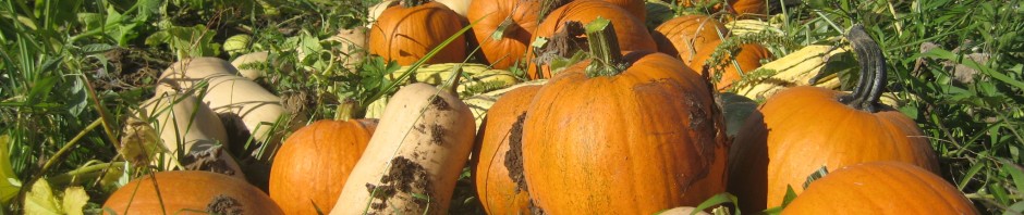
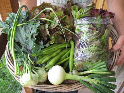
Meet this week’s vegetables:
Yes, high water … in June!!!!!!!!
You may have noticed all the rain we received in May and early June — way higher amounts than average. All that precipitation culminated finally in another extreme event: the Willamette River rose almost to its ‘action stage’ (pre-flooding high waters)!
We went to bed on Friday night knowing that this was possible and woke up on Saturday morning to a rising ribbon of water flowing across our lowest ground. As far as extreme weather events goes, this one was much more peaceful in its execution than last June’s storm (hail, high winds, flooding downpours). The water was glassy and beautiful really as it crossed our property from a culvert on one side to the slough on the other.
Of course, its beauty belied its potentially damaging nature. We still don’t know what the short or long-term impacts of this high water event will be, because as of tonight (Monday), the water is still slowly receding.
Fortunately, Oakhill Organics was spared (for now!). Even at its highest point (20.9 ft in Salem — just below ‘action stage’), none of our crops were inundated except for a tiny corner of our experimental peanut planting. We were lucky this happened this year and not last, because the wide band of water completely covered the field where we grew all of our spring crops last year.
Unfortunately, the water did reach the vegetable crops being grown by our employee Jeff and his wife Carri for their farm Pitchfork & Crow. The water submerged the ends of many of their beds. We figured out how deep the water was when we watched their two-foot tall irrigation risers finally go under at the river’s crest. Their crops are slowly re-emerging now and so far things look like they’re still alive, but it will take a few days to tell for sure.
Other fields on Grand Island fared even worse. Many lower fields reserved by farmers for summer crops (for example, cannery corn and beans) went completely under. On Saturday, I took Rusty for a long walk around the island just before the river crested. On the way down, I passed the proposed 225-acre gravel quarry site. From the road, it appeared to be mostly dry; however, by the time I wrapped around and could see it from the south, I could see a lot of water on the land closest to the same slough that runs along our property’s eastern boundary (locally known as ‘Skeeter Creek’ — yes, it lives up to its name!).
On the way back, there was water flowing over the road at the quarry site where it hadn’t been less than an hour before. It’s amazing to think of how much water is in the river to make it rise that fast over such a large area!
Observing this high water event was also an interesting study in the accuracy of modeling. NOAA maintains a useful website that tracks the river level at various spots and predicts the upcoming rise or fall over the next few days. The modeling is computer generated and based on river data collected over decades — I imagine that it’s as accurate as any model of the river can be.
We watched that website carefully before and during the high water event. As of Thursday, it had predicted water as high as it was in January 2009, when a large chunk of our cropped ground went under. By Friday evening, it had downgraded quite a bit to a level that possibly wouldn’t even wet any of our fields.
Yet of course Saturday morning our fields were very wet and got wetter all day even as the website continued to predict that the river would stop rising at any moment. The peak of the graph ended up being much flatter (i.e. more time) than predicted, meaning that high water affected the island for longer than we expected. As I said earlier, lower fields are still completely flooded right now, two and a half days later.
Why is this observation of modeling limits and inaccuracies interesting to us right now? The proposed quarry is also on our minds these days, and the quarry application is chock full of hydrologic models.
The second of two hearings in front of the Yamhill County Planning Commission was last Thursday — they’ll announce their recommendation at their July 1st meeting and then the proposal will go before the Board of Commissioners, who will make the final decision about whether or not we’ll have another approved quarry site on Grand Island.
What makes this quarry uniquely different from the already approved quarry on the island is that it’s upstream from everyone (whereas the other site is downstream, on the north end of the island). Any changes to the site could potentially affect the movement of river waters during high water events such as these. The quarry application is full of models and data, and their hired hydrogeologist has concluded that the site is ‘geomorphically stable’ and that the quarry operations will not create ‘significant’ changes to the movement of waters.
Call me a skeptic, a luddite, or a realist, but I just don’t trust all the models. From talking to the ‘old-timers’ on the island, we’ve learned that the floods are tricky to predict and that almost any change can have a big impact — even something as seemingly benign as blackberry removal can increase floodwater velocity.
In the high water even two Januaries ago, we saw the ‘scouring’ damage created by velocity — when those waters receded, they left ‘pot holes’ in our field created by the roiling water. And in that event, the water seemed just as glassy and calm as it does today. We haven’t even seen the powerful, fast-moving big flood events (for example 1996 and 1964). So, when someone starts proposing digging really big, really deep holes upstream from our farm, we get nervous. Really nervous.
And this high water event only drives home how unpredictable the river can be. River levels this high in June are completely unprecedented. Maybe this spring is just a complete fluke, but maybe it’s also indicative of changing trends in Northwest weather. At this point, I’d prefer to error on the conservative side when it comes to big changes that could affect a very large number of people, farms, and businesses.
Anyhow, these are things that were on our mind this weekend — What would this high water event have been like if the quarry had already been in operation? How might climate change affect future springs? What are the limits of river models that are based on an ever-changing climate and topography?
Of course, Grand Island wasn’t the only place negatively affected by this spring’s weather and the flooding. We’ve been hearing reports of increased plant diseases all over the Northwest; hay farmers haven’t been able to cut and bale their crops; and other places have experienced high water as well.
A friend of ours who farms in Junction City reported that they had three-foot tall zucchini plants completely under water, and one of their neighbors had to pull their market harvest out of the field with a kayak. Do I need to point out, once again, that all of this is happening in June? What a weird weird weird spring.
Fortunately, even as the waters were coming up, so was the temperature. It still isn’t as warm as ‘normal’ or ‘average,’ but we’ve been experiencing the consistently warmest temperatures of the year in the last few days. The plants are appreciating it, and so are we humans … although with the rain, it feels an awful lot like we’re living in the Northeast rather than the Northwest!
Enjoy this week’s vegetables!
Your farmers, Katie & Casey Kulla
Coming up! …
Sometime soon ~ The CSA pick-up will move to the newly remodeled Market building in the Granary District! We’ll keep you posted for the date when we know it.
June 27 ~ Open House at the farm! More details in next week’s newsletter!
July 1 ~ Third $240 payment due for folks on on the quarterly payment plan!